East Side Story
April 28, 2013Ted writes:
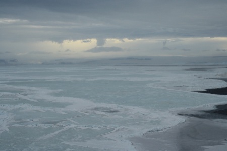
After returning from the day trip to the Crane Overlook site on April 17, we received satellite images that completely changed our plan. The images from both a NASA and a Canadian satellite showed that persistent westerly winds starting in early April had opened a large gap in the sea ice just to the east of the Larsen A, B, and C—a long highway of dark water that we could use to get to areas we have been trying to reach for four years. But the opened road on the eastern Peninsula came with a significant risk: at this point in the Antarctic season, such a path could freeze over or slam shut in a matter of days, making it difficult even for a powerful icebreaker like the Araon to escape.
The KOPRI (Korean Polar Research Institute) scientists were willing to take the risk, in part because the ship is fairly fast, capable of up to 14 knots, and because the science potential was high. The weather is much drier on the leeward eastern side of the Antarctic Peninsula, so we would be likely to fly more often. Communications and weather safety are better because one can see conditions approaching the ship or the field site from a long distance (without the blocking of the high Antarctic Peninsula ridge).
That evening, we took the ship as fast as possible over the northern tip of the Peninsula to the eastern side and sailed down into the gap less than two days later.

A tabular iceberg passed near Snow Hill Island as the Araon headed south toward the Larsen B region. (Credit: Ted Scambos, NSIDC)

A flock of emperor penguins, assembled on an ice floe near Snow Hill Island. (Credit: Ted Scambos, NSIDC)
And there we were: at the fast ice edge of the Larsen B Ice Shelf, ready to fly with helicopters to the three major glaciers of our study area, one of them already fast-moving and thinning as a result of global warming (Crane Glacier), and two others (Flask and Leppard glaciers) that were poised to change if the last remnant of the Larsen B, the Scar Inlet Ice Shelf, collapsed.

Rifts near the calving front of Scar Inlet Ice Shelf could eventually form tabular icebergs. (Credit: Ted Scambos, NSIDC)
The next day (April 20) was clear and warm. The forecast suggested a gradual shift to cooler southern winds by late in the day. We loaded the helos according to a complex plan, trying to get as much done as possible. We would identify a second rock outcrop and install a seismic monitoring station, and begin work on a multi-instrument AMIGOS site on a small crevasse-free section of lower Leppard just a few miles away from the seismic site.
The flight to Leppard was spectacular and revealing. The remnant Scar Inlet shelf from the once-vast Larsen B is now completely fragmented, as cracked as a windshield after an accident, with huge deep rifts indicating fractures on the underside of the floating ice as well. It is clear that the next warm summer will be the last one for this shelf. We were eager to get to our site and get going.

Closely spaced crevasses on Scar Inlet Ice Shelf could fill with melt water during the next warm summer, leading to a possible disintegration event as happened to the main Larsen B in 2002. (Credit: Ted Scambos, NSIDC)
But there were problems. Our search on the mountain next to Leppard Glacier for a good seismic mounting site was hampered by bumpy winds around the peaks. Lower down, the rock sites were covered in gravel and loose talus, and were not suitable. So we decided to put the seismic station on the glacier at the AMIGOS site. Problems with the Iridium satellite phones arose. We could not contact the ship, except using the helicopter radios, and they had to be aloft to make a clear call.

Ted Scambos records some notes on Leppard Glacier. The field instrument next to Ted is a backpack-mounted, gas-powered steam drill.
(Credit: Jennifer Bohlander, NSIDC)

Rob Bauer (in black) and Erin Pettit (in orange) ready equipment prior to to a radar traverse of Leppard Glacier. (Credit: Ted Scambos, NSIDC)
Slowly things moved along despite these obstacles. We conducted a radar survey, skiing a few km across the glacier. The seismic crew began to build the station. A Korean geologist and I returned to the ship in early afternoon. On the flight back, I noticed low fog forming over the Scar, a very ominous sign. Fog had trapped a group of us for over a week in 2010, and that was in summery January, not April. When we landed I asked the pilots to hurry back and get the rest of the crew right away.

An approaching fog bank was the precursor to an intense snow squall that forced a retreat from Leppard Glacier by the remaining field team of seven scientists. (Credit: Ted Scambos, NSIDC)
But after the helos left, we realized that fog was only the beginning of the weather change. Far from being a gradual wind shift, a sudden abrupt blast of south wind hit the ship, and within minutes we were engulfed in cold blowing snow and mist. Temperatures plummeted. Our sunny day was going to end with a powerful snow squall, with seven scientists still at the Leppard site. Conditions remained beautiful there, 70 miles away.

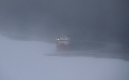
The Araon, enshrouded in freezing mist and battling 40 knot winds at the Larsen B fast ice edge, awaits the final helicopter returning with a field party from Leppard Glacier. (Credit: Erin Pettit, University of Alaska Fairbanks)
We radioed the pilots and told them about the declining conditions at the ship, and they loaded the passengers and headed back. By the time they arrived at the ship, a gale of 40 knots was blowing, and visibility was only a mile or so. The pilots made two amazing landings in the blustery winds, with all passengers and gear safely returned.
By nightfall, winds had risen to 60 knots out of the south, with temperatures near zero degrees Fahrenheit. The scientists and ships crew realized that these were exactly the worst conditions for keeping the narrow lane of ocean clear of ice. Cold winds would freeze the open water, and the pack to the east of us (full of thick older ice) would start to shift westward and close us in. The Araon put on all speed and glided through the gathering slushy ice, a gale at its back, until we were north of Robertson Island (the most likely ‘pinch point’ for the drifting ice to close us in).
We were not done though—as the first gale subsided the next day, we returned south again, finding that the road was narrow but not completely shut. We traveled past the Larsen B into the Larsen C, almost touching the Antarctic Circle (in late April!) and collected a core from a key site of the Larsen C. On our way north again, we launched a quick mission to recover gear that had to be left behind when the squall hit. Then we left for good, as the oncoming Antarctic winter was rapidly freezing the sea around us.
We now are again on the west side, in a fjord called Flandres Bay, just opposite our main instrument sites, with one more week to get some stations installed.
Tomorrow looks like flyable weather.


